 |
 |
 |
 |
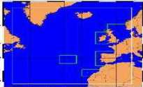
| Hindcast of Dynamic Processes of the Ocean and Coastal Areas of Europe | |||
| domingo, 28 de junho de 2026 | |||
|
|
||||||||||||||||||||||
MéteóMer |
||||||||||||||||||||||
 MéteóMer is a French private company dedicated to world-wide metocean
services for all maritime activities: - Maritime meteorological and swell forecast, for real time assistance,
- Field measurements of waves, winds and currents, - Operational metocean studies, relying upon satellite measurements, combined with wave propagation and stochastic models. MéteóMer was involved in a partnership with Ifremer (Institut Français
de Recherche pour l"Exploitation en Mer), in construction of the CLIOSat
system (Satellite Metocean Climate), distributed worldwide. This general
sea-state and wind applied climatology product includes two modes: a
satellite metocean climate Atlas, on CDROM, and an on-line service,
for insight into a particular area. With special emphasis on satellite data, MéteóMer has already performed
several operational studies, most of them in deep-water conditions.
The coastal applications rely upon the basic use of numerical models.
MéteóMer will bring to the project its experience in operational use
of satellite data for offshore and coastal areas studies. This includes
compilation and calibration of all available satellite wind and wave
measurements (~ 10 years). Its experience with CLIOSat will be used
to set up the statistics and to produce the Atlas of European data. MéteóMer
was a leader of the French joint industry project "Use of satellite
data for applied knowledge of maritime environment". This leads in part
into the production of the CLIOSat. MéteóMer participated into a CEO project "Remote Sensing Support for
Analysis of Coasts" (ENV4-CT96-0369). The contributions to this project
were the construction of a metocean database characterizing the Israel
coastal area with the contribution of satellite data and the estimation
of the potential longshore sand transport rates. MéteóMer has already performed around 50 operational studies relying
upon the combined used of satellite data, wave propagation and stochastic
models. |
||||||||||||||||||||||
| (Back) | ||||||||||||||||||||||
| Home | Overview | Workplan | Members | Documents | Information | Login | ||||||||||||||||||||||
|
© 2002 HIPOCAS Optimized for Internet Explorer 5+ | ||||||||||||||||||||||